Fuerteventura offers a wide range of possibilities for leisure activities in nature. Cycle tourism is one of them and the one that brings more followers to the island.
If you like quiet cycling routes, without many slopes and with wide dirt tracks, then the route that we propose today will surely interest you.
The route, just 9 kilometers long, connects Villaverde with the Parque Holandés and is one of the best options to get to know this part of Fuerteventura.
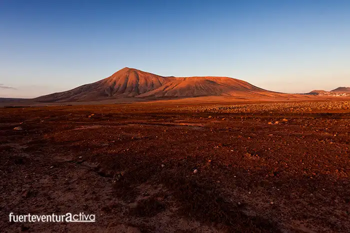
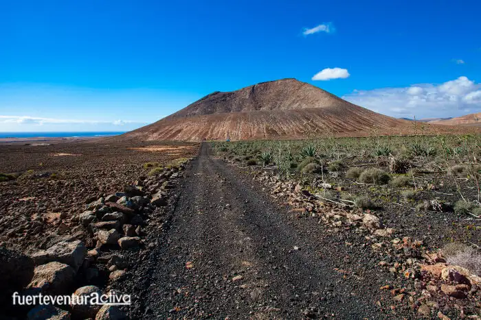
The landscape is arid and relatively flat. It is crossed by numerous ravines, which have been formed by runoff waters and have created a powerful aquifer in the subsoil. Three volcanic cones: Escanfraga, Montaña Negra and Montaña Caima, rise up like imposing guardians in the middle of this plain.
The trail passes through diverse landscapes such as fossilized dunes or badlands, environments that will transport you to other times.
Start of the Route
The beginning of the cycle route is on the right bank of the FV-101 highway, right at the new CEIP Villaverde.
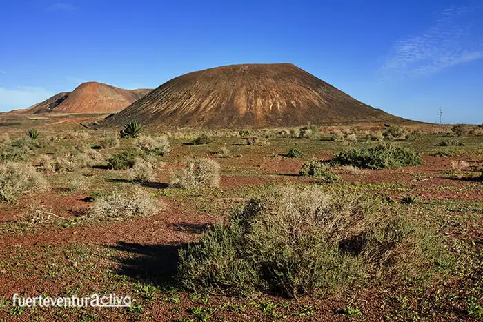
The first elevation on the right is Montaña Escanfraga, one of the most significant volcanic cones in the entire municipality of La Oliva. A little further on and to the left is Montaña Negra, which with its blackish and ocher tones, gives the landscape a nice contrast.
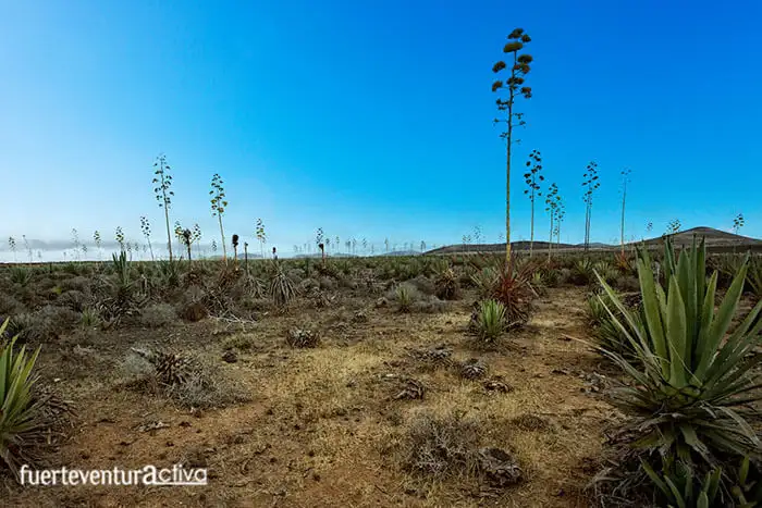
With the first pedaling through Rosa Erguida (which is what this cultivated area is called), the large number of abandoned piteras in the surroundings are striking.
The piteras of Villaverde were planted in the middle of the 20th century. In those years, Spain lived under a dictatorship and the country was subjected to a strict international economic blockade. The Franco regime launched several projects with the intention of making Spain as self-sufficient as possible. The planting of piteras, in sanding systems, was part of the projects carried out in Fuerteventura.
A powerful fiber used in the textile industry is extracted from the piteras. With it, boat ropes, hammocks, mats, etc. are manufactured.
If you look at this part of Villaverde from Googlemaps, you will see the parcelling of the land in black, cultivated with piteras. We owe this blackness to the thousands of tons of picón (lapilli) with which the ground was covered before planting the piteras. The picón is the base of this cultivation system called enarenado, very typical of the Canary Islands.
By the way, the treatment center for Hard Fibers from piteras was at the entrance to Villaverde, near the church.
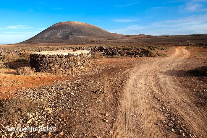
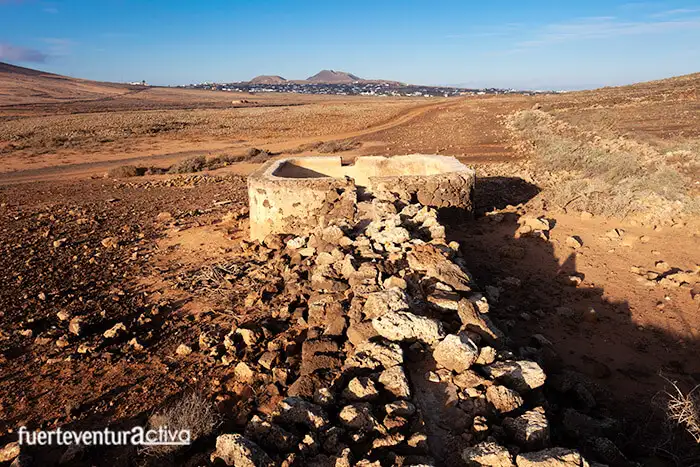
In this first part of the route you will also pass through the remains of a farmhouse and two cisterns made of stone, elements that remind us how complicated it is, in Fuerteventura, to get a supply of water.
Precisely, one of these cisterns, the one with a circular floor plan and a concrete cover, becomes a point of reference. When you reach it, it is time to turn slightly to the left and face the next elevation: Montaña Caima.
2nd Section – Caima Mountain
Montaña Caima is aligned with the volcanic cones of Escanfraga and Montaña Roja.
Montaña Caima is easy to identify, as it has a pyramidal shape. On its northeast side, through which we will pass, a large horseshoe-shaped crater opens. But if you want to take more spectacular images of this volcanic cone, you will have to go to the opposite side: to the southwest flank. There the lava tongues are covered by sandy-clay deposits, and are partially filled with volcanic ash. You will find a unique landscape with fossilized plant roots, caves and crudely built dams to channel rainwater.
3rd Section - arrival at Parque Holandés
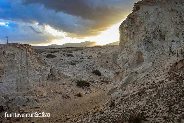
We will skirt Montaña Caima, which is on the right. We will cross the new Autovía del Norte, over a bridge, and head towards the Llano de Caima. Once we reach the Barranco del Lomo Cumplido we will observe, on the first curve to the right, some fossil dunes from the Pleistocene, with an approximate age of between 1.7 and 0.4 million years.
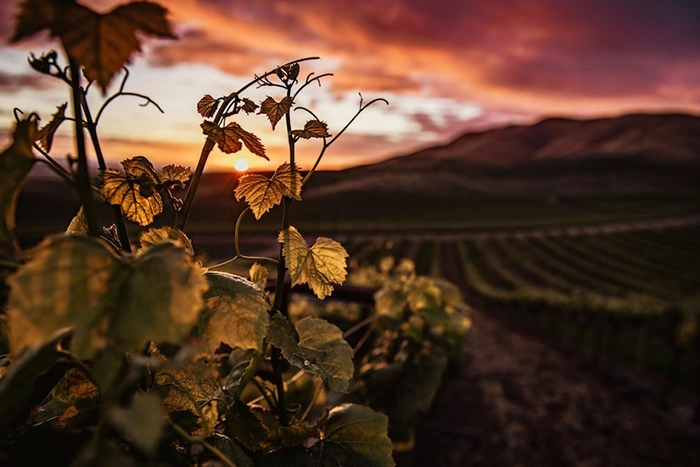
Here it is worth making a stop. At sunset the dunes turn warm colors, almost orange. We might think that we are in a movie landscape of the American West.
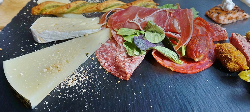
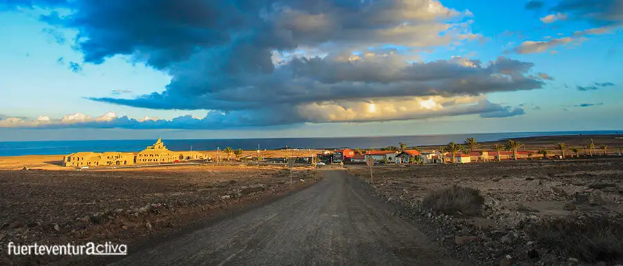
From here the track becomes steeper. We will see a few meters away that the Parque Holandés is very close. The trail ends right in front of a restaurant where you can taste the rich Majoreragastronomy or simply have a snack.
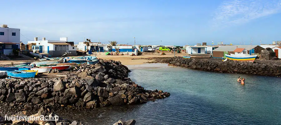
Shall we go to the beach?
Although the 13th cycle route ends here, you can reach El Jablito beach, which is just 500 m away. It is a small fishing settlement that still retains its authenticity.
Flora and fauna of the environment.
Vegetation is scarce on this route that we propose today. In addition to piteras, gorse, tabaibas and Moorish tobacco, which colonizes the most unexpected places, the Tojia Blanca lives here, a plant endemic to the area and which is critically endangered.
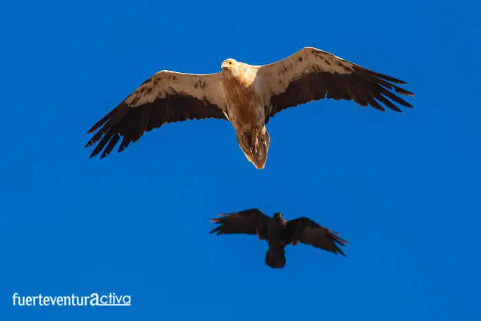
The fauna from Villaverde to Parque Holandés is not very varied. The most remarkable thing is the presence of eagles, shrikes, Canary stonechats, Canary crows, guirres, and kestrels. Within the mammals it is easy to find squirrels, rabbits, hedgehogs, and canary shrews. The lisnejas are the most representative reptiles of this area.
Information of interest: Route 13: Villaverde – Parque Holandés
 The landscape is arid and relatively flat. It is crossed by numerous ravines, which have been formed by runoff waters and have created a powerful aquifer in the subsoil. Three volcanic cones: Escanfraga, Montaña Negra and Montaña Caima, rise up like imposing guardians in the middle of this plain.
The trail passes through diverse landscapes such as fossilized dunes or badlands, environments that will transport you to other times.
The landscape is arid and relatively flat. It is crossed by numerous ravines, which have been formed by runoff waters and have created a powerful aquifer in the subsoil. Three volcanic cones: Escanfraga, Montaña Negra and Montaña Caima, rise up like imposing guardians in the middle of this plain.
The trail passes through diverse landscapes such as fossilized dunes or badlands, environments that will transport you to other times.
 The beginning of the cycle route is on the right bank of the FV-101 highway, right at the new CEIP Villaverde.
The first elevation on the right is Montaña Escanfraga, one of the most significant volcanic cones in the entire municipality of La Oliva. A little further on and to the left is Montaña Negra, which with its blackish and ocher tones, gives the landscape a nice contrast.
With the first pedaling through Rosa Erguida (which is what this cultivated area is called), the large number of abandoned piteras in the surroundings are striking.
The beginning of the cycle route is on the right bank of the FV-101 highway, right at the new CEIP Villaverde.
The first elevation on the right is Montaña Escanfraga, one of the most significant volcanic cones in the entire municipality of La Oliva. A little further on and to the left is Montaña Negra, which with its blackish and ocher tones, gives the landscape a nice contrast.
With the first pedaling through Rosa Erguida (which is what this cultivated area is called), the large number of abandoned piteras in the surroundings are striking.
 The piteras of Villaverde were planted in the middle of the 20th century. In those years, Spain lived under a dictatorship and the country was subjected to a strict international economic blockade. The Franco regime launched several projects with the intention of making Spain as self-sufficient as possible. The planting of piteras, in sanding systems, was part of the projects carried out in Fuerteventura.
A powerful fiber used in the textile industry is extracted from the piteras. With it, boat ropes, hammocks, mats, etc. are manufactured.
If you look at this part of Villaverde from Googlemaps, you will see the parcelling of the land in black, cultivated with piteras. We owe this blackness to the thousands of tons of picón (lapilli) with which the ground was covered before planting the piteras. The picón is the base of this cultivation system called enarenado, very typical of the Canary Islands.
The piteras of Villaverde were planted in the middle of the 20th century. In those years, Spain lived under a dictatorship and the country was subjected to a strict international economic blockade. The Franco regime launched several projects with the intention of making Spain as self-sufficient as possible. The planting of piteras, in sanding systems, was part of the projects carried out in Fuerteventura.
A powerful fiber used in the textile industry is extracted from the piteras. With it, boat ropes, hammocks, mats, etc. are manufactured.
If you look at this part of Villaverde from Googlemaps, you will see the parcelling of the land in black, cultivated with piteras. We owe this blackness to the thousands of tons of picón (lapilli) with which the ground was covered before planting the piteras. The picón is the base of this cultivation system called enarenado, very typical of the Canary Islands.
 By the way, the treatment center for Hard Fibers from piteras was at the entrance to Villaverde, near the church.
In this first part of the route you will also pass through the remains of a farmhouse and two cisterns made of stone, elements that remind us how complicated it is, in Fuerteventura, to get a supply of water.
By the way, the treatment center for Hard Fibers from piteras was at the entrance to Villaverde, near the church.
In this first part of the route you will also pass through the remains of a farmhouse and two cisterns made of stone, elements that remind us how complicated it is, in Fuerteventura, to get a supply of water.
 Precisely, one of these cisterns, the one with a circular floor plan and a concrete cover, becomes a point of reference. When you reach it, it is time to turn slightly to the left and face the next elevation: Montaña Caima.
 Montaña Caima is easy to identify, as it has a pyramidal shape. On its northeast side, through which we will pass, a large horseshoe-shaped crater opens. But if you want to take more spectacular images of this volcanic cone, you will have to go to the opposite side: to the southwest flank. There the lava tongues are covered by sandy-clay deposits, and are partially filled with volcanic ash. You will find a unique landscape with fossilized plant roots, caves and crudely built dams to channel rainwater.
 Here it is worth making a stop. At sunset the dunes turn warm colors, almost orange. We might think that we are in a movie landscape of the American West.
From here the track becomes steeper. We will see a few meters away that the Parque Holandés is very close. The trail ends right in front of a restaurant where you can taste the rich Majorera gastronomy or simply have a snack.
Here it is worth making a stop. At sunset the dunes turn warm colors, almost orange. We might think that we are in a movie landscape of the American West.
From here the track becomes steeper. We will see a few meters away that the Parque Holandés is very close. The trail ends right in front of a restaurant where you can taste the rich Majorera gastronomy or simply have a snack.
 The fauna from Villaverde to Parque Holandés is not very varied. The most remarkable thing is the presence of eagles, shrikes, Canary stonechats, Canary crows, guirres, and kestrels. Within the mammals it is easy to find squirrels, rabbits, hedgehogs, and canary shrews. The lisnejas are the most representative reptiles of this area.