Routes and trails
3 unique routes to do in the north of Fuerteventura
We agree that your holidays are the best time of the year to take a break, also to get to know and explore Fuerteventura. This island is mainly known for its beach beaches, but it also has other attractive natural resources that are worth discovering.
In Fuerteventura you will find routes and paths for all tastes, from those with gentle slopes that border the coast of Fuerteventura, to those that take you to the highest levels of the island.
Today we propose to connect, through hiking routes, Corralejo with Esquinzo beach, one of the quietest in the north of Fuerteventura. For this we have divided this super route into 3 independent stages, so you can do it in 3 days.
Stage 1: Corralejo – Los Lajares
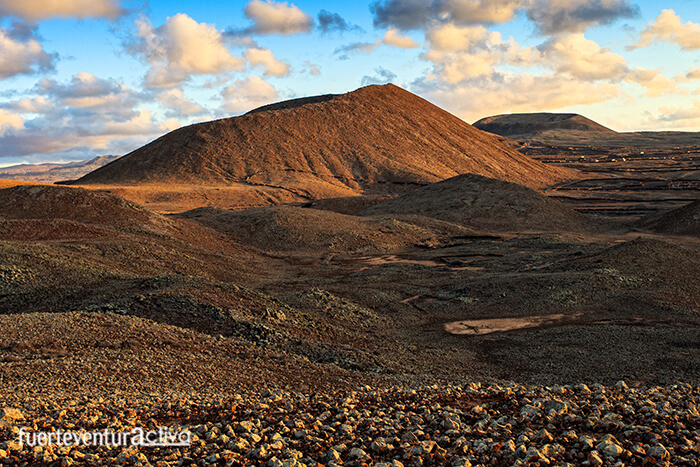
The first stage links Corralejo with the town of Los Lajares.
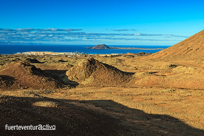
This route, of just over 10 kilometers, is suitable for almost all ages and physical conditions. A wide and winding dirt path takes you through a spectacular landscape made up of badlands. Carrying out this itinerary becomes a didactic way of discovering the most recent volcanoes of Fuerteventura: Those that form the Bayuyo alignment.
The path is comfortable, without great slopes and is in good condition. You can explore it both on foot and by bike, even a section of it by vehicle.
If you want to surprise your partner with one of the most romantic sunsets that the north of Fuerteventura has to offer, don’t hesitate, come to the path that runs along the slopes of the Bayuyo volcanic cones. The color palette, displayed by the youngest malpaises of the island, at sunset are hypnotizing.
To start the route, look for the Corralejo football field. A little further up there is a roundabout with a sculpture of a ship whose sail represents different sports. Go up the track that indicates “Morro Francisco”. A few meters away you will see a brand new urbanization. Take the second street on the right until you reach a municipal water tank. That’s where the ride really begins. First you will pass through the San Rafael Mountain, followed by Bayuyo, Las Calderas, Caldera Encantada, Caldera Rebanada, and Calderón Hondo. This last volcanic cone can be visited and has good access.
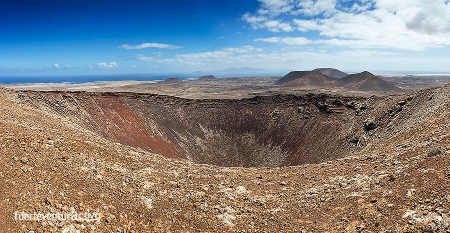
After approaching Calderón Hondo, follow the path to Los Lajares. There are bars and restaurants where you can recharge your batteries.
Throughout the tour you will see sidings and information signs. In the badlands of Bayuyo, the hornitos stand out: small holes through which the gases of the volcanic eruptions were released.
The estimated time to make the journey from Corralejo to Los Lajares via Bayuyo is approximately 3 hours.
Stage 2: Los Lajares – Esquinzo Ravine
The next stage consists of going from Los Lajares to the Barranco de Esquinzo passing through one of the best-known trails in Fuerteventura, the one that runs through the Barranco de los Encantados.
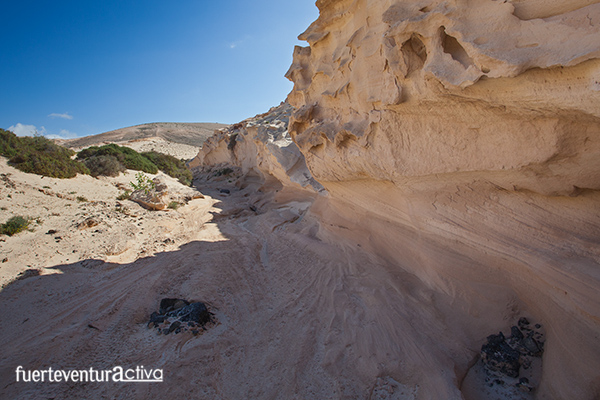
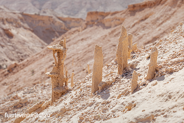
This route is about 11 kilometers long and passes through a spectacular landscape, made up of fossil dunes of marine origin. In some sections the dunes form vertical walls 20 meters high. In addition to contemplating the capricious forms, which have been created by water and modeled by the wind, you will have the opportunity to see fossils of animal and plant origin.
Although the route is mostly downhill, this itinerary is somewhat more demanding than the previous one. There are hardly any signposts so, if it is the first time you come to the area, you will have to use apps like Googlemaps or maps.me from time to time. This last app is extremely useful for plotting your route in areas where there is little or no telephone coverage.
The starting point of today’s route is in Cañada Melián. To access it you just have to leave the town of Los Lajares towards El Cotillo. At the confluence of the FV-109 and FV-10 roads you will see a roundabout. Cross it and enter the sands that you will see in front.
Although the route is mostly downhill, this itinerary is somewhat more demanding than the previous one. There are hardly any signposts so, if it is the first time you come to the area, you will have to use apps like Googlemaps or maps.me from time to time. This last app is extremely useful for plotting your route in areas where there is little or no telephone coverage.
The starting point of today’s route is in Cañada Melián.
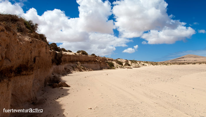
To access it you just have to leave the town of Los Lajares towards El Cotillo. At the confluence of the FV-109 and FV-10 roads you will see a roundabout. Cross it and enter the sands that you will see in front.
When you have walked about 150 meters, from the roundabout, turn right until you reach a wide bed of sea sand. You are already in Cañada Melián. Continue along the ravine, towards the sea, to its head, where it joins the Barranco de los Encantados or Enamorados. Keep going down the ravine until you find a dirt track suitable for vehicles.
Stage 3: Esquinzo Ravine – Esquinzo Beach
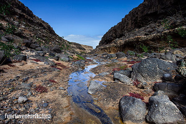
We start the route in the valley that forms the Barranco de Esquinzo with the dirt track that connects El Cotillo with Tindaya. To make it easier for you, here is the link to the start of the route on Googlemaps.
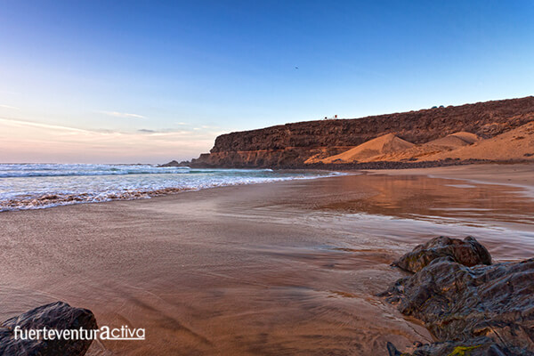
The 2.5-kilometre route brings you closer to the Esquinzo beach in about 45 minutes, along the sinuous bed of the ravine, which is flanked by imposing vertical walls. Esquinzo Beach is a quiet cove in the shape of a horseshoe. It is somewhat rocky, but its soil is made up of golden sand and pebbles. It measures just over 300 meters in length and its average width is close to 30 meters. Like other beaches on the west coast of Fuerteventura, this one in Esquinzo is also flanked by high cliffs, which protect it from the rough sea and the prevailing winds.
Fuerteventura2 Fuerteventura1

