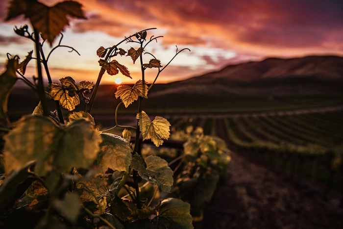
When landing on our island, the wind is usually the first to welcome us. So we think that the meaning of its name is closely related to the wind. But we have already seen in other articles, that it has nothing to do with it!
The truth is that Fuerteventura has earned a reputation for being very windy, making this feature one of its tourist attractions. But, is it certainly so bad?
The weather and the wind of Fuerteventura
Fuerteventura is characterized by having a climate without excessive variations, of great atmospheric stability. This is largely due to its geographic location: 28º North latitude, integrated within the Macaronesia region and close to the African continent.
All this means that this Atlantic region has a peculiar atmosphere and climate.
One of the singularities of the atmosphere in the Canary Islands is that of having a vertical structure with several layers:
- The lower layer is characterized by a moist and fresh surface air, in which the winds of the East component predominate.
- In the upper layer the dominant circulation is from the West and Southwest. They are hot and dry winds.
Therefore, we could say that the atmosphere of the Canary Islands is tropical in the ground and temperate in height.
Between the two layers is the strip called thermal inversion. In this space, the humidity of the Trade Winds condenses, stagnating when it is slowed by the reliefs of the island, and generating the characteristic sea of clouds. In Fuerteventura you can see the sea of clouds on the windward slopes, both in the Pico de la Zarza and in the Betancuria massif. These are the areas with the highest humidity and rainfall on the island.
The strip of thermal inversion is situated in summer at about 600-1000 meters high and in winter higher, at about 1500 meters. That is why it is easier to see the stagnation of the clouds in Fuerteventura during the summer than during the winter.
What are the Alisio winds?
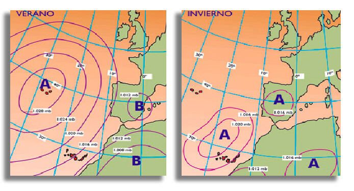
The Canary Islands are protected by the Azores Anticyclone, which rotates clockwise. We call this flow generated on the eastern flank of the Azores anticyclone Alisios, and it always runs over ocean waters.
Therefore, theAlisio Winds are the constant winds that blow in the Canary Islands, they come from the polar areas and go to the equatorial areas. Deflected by the rotation of the earth, they come to us from the northeast.
The Alisio is a wind that, thanks to the continuous contact with the cold waters of the Canary current, brings freshness and humidity on the surface. Added to this beneficial effect is its moderate speed of 20-25 km / h. The direction is constant from East-Northeast.
In summer these winds are almost permanent while in winter they are distributed almost evenly.
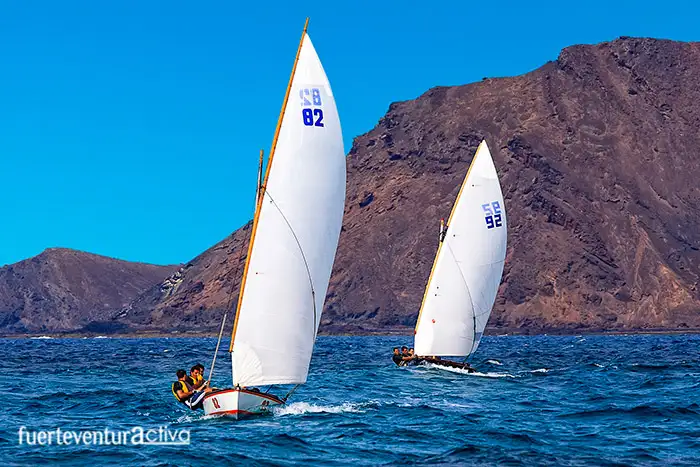
The direction and moderate strength of the alisio winds have also played a fundamental role in maritime navigation. Formerly they were called winds of trade. Thanks to them, the sailing ships of the 15th and 16th centuries were able to cross the Atlantic Ocean, making the Canary Islands the strategic stopping point.
If you ask yourself, how did they return? The answer is simple. Since it was impossible to navigate with the trade winds against, the navigators sought another route, a little further north, where the west winds predominate.
When the Azores anticyclone weakens and retreats to the northwest, Saharan continental air masses advance towards the islands that produce southerly weather, which leads to warmer temperatures in summer, a sharp drop in relative humidity, and cloudiness of the air by the dust particles it contains.
Thanks to the strong winds that blow during the summer, the land does not heat up too much, also preventing the air from becoming unbreathable for days.
When the distance between the anticyclone and the Canary Islands is less, the intensity of the Alisio winds will be less than when that distance is greater. In winter the winds are loaded with less humidity as they have traveled less space in contact with the sea. The wind is greater in the border areas of the Anticyclone. For this reason, as the Azores Anticyclone moves to the north, in the summer and autumn months, the action of the alisio winds is more intense, and the wind speed increases in the region of the Canary archipelago. Also gives rise to moisture-laden clouds
Why is the air stronger in some areas of the island than in others?
We could say, roughly, that the wind blows constantly but the Canary archipelago stands in its way. The islands are an obstacle in the middle of their journey and since the wind does not know how to cross these obstacles, it must avoid them on their sides, which means a greater "flow" of air, which acts as a funnel in certain parts of the island.
This effect can be felt in various parts of Fuerteventura, one of them in Degollada de Ovejas, just on the road that goes down to Cofete beach.
When is it less windy in Fuerteventura?
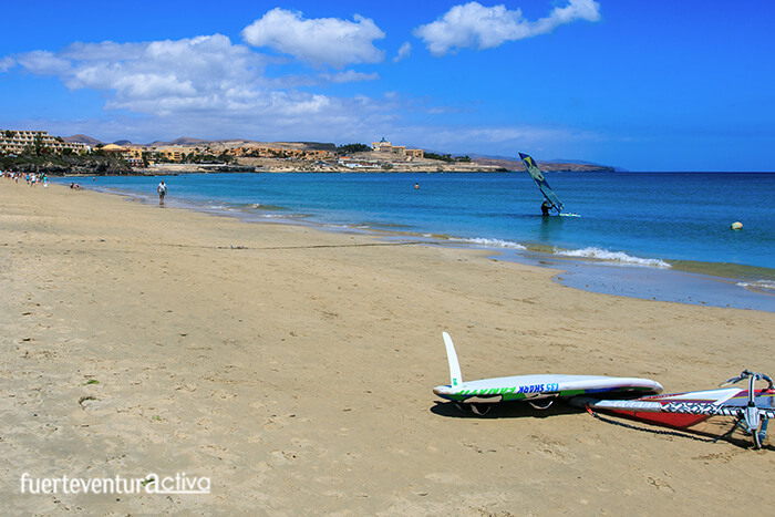
The best time to visit Fuerteventura with hardly any wind is during September, October and even November, since the trade winds are at their lightest (15-20 km / h) and the sea is at its warmest, about 22-23º C.
However, until the end of May the wind is not very intense on the island and it is perfectly supported. It is no coincidence that Fuerteventura has positioned itself as one of the best winter tourist destinations.
When is it less windy in Fuerteventura?
The best time to visit Fuerteventura with hardly any wind is during September, October and even November, since the trade winds are at their lightest (15-20 km / h) and the sea is at its warmest, about 22-23º C. However, until the end of May the wind is not very intense on the island and it is perfectly supported.
It is no coincidence that Fuerteventura has positioned itself as one of the best winter tourist destinations.
[ux_product_categories]
Fuerteventura6 Fuerteventura5

 Between the two layers is the strip called thermal inversion. In this space, the humidity of the Trade Winds condenses, stagnating when it is slowed by the reliefs of the island, and generating the characteristic sea of clouds. In Fuerteventura you can see the sea of clouds on the windward slopes, both in the Pico de la Zarza and in the Betancuria massif. These are the areas with the highest humidity and rainfall on the island.
The strip of thermal inversion is situated in summer at about 600-1000 meters high and in winter higher, at about 1500 meters. That is why it is easier to see the stagnation of the clouds in Fuerteventura during the summer than during the winter.
Between the two layers is the strip called thermal inversion. In this space, the humidity of the Trade Winds condenses, stagnating when it is slowed by the reliefs of the island, and generating the characteristic sea of clouds. In Fuerteventura you can see the sea of clouds on the windward slopes, both in the Pico de la Zarza and in the Betancuria massif. These are the areas with the highest humidity and rainfall on the island.
The strip of thermal inversion is situated in summer at about 600-1000 meters high and in winter higher, at about 1500 meters. That is why it is easier to see the stagnation of the clouds in Fuerteventura during the summer than during the winter.
 The Canary Islands are protected by the Azores Anticyclone, which rotates clockwise. We call this flow generated on the eastern flank of the Azores anticyclone Alisios, and it always runs over ocean waters.
Therefore, theAlisio Winds are the constant winds that blow in the Canary Islands, they come from the polar areas and go to the equatorial areas. Deflected by the rotation of the earth, they come to us from the northeast.
The Alisio is a wind that, thanks to the continuous contact with the cold waters of the Canary current, brings freshness and humidity on the surface. Added to this beneficial effect is its moderate speed of 20-25 km / h. The direction is constant from East-Northeast.
The Canary Islands are protected by the Azores Anticyclone, which rotates clockwise. We call this flow generated on the eastern flank of the Azores anticyclone Alisios, and it always runs over ocean waters.
Therefore, theAlisio Winds are the constant winds that blow in the Canary Islands, they come from the polar areas and go to the equatorial areas. Deflected by the rotation of the earth, they come to us from the northeast.
The Alisio is a wind that, thanks to the continuous contact with the cold waters of the Canary current, brings freshness and humidity on the surface. Added to this beneficial effect is its moderate speed of 20-25 km / h. The direction is constant from East-Northeast.
 In summer these winds are almost permanent while in winter they are distributed almost evenly.
The direction and moderate strength of the alisio winds have also played a fundamental role in maritime navigation. Formerly they were called winds of trade. Thanks to them, the sailing ships of the 15th and 16th centuries were able to cross the Atlantic Ocean, making the Canary Islands the strategic stopping point.
If you ask yourself, how did they return? The answer is simple. Since it was impossible to navigate with the trade winds against, the navigators sought another route, a little further north, where the west winds predominate.
When the Azores anticyclone weakens and retreats to the northwest, Saharan continental air masses advance towards the islands that produce southerly weather, which leads to warmer temperatures in summer, a sharp drop in relative humidity, and cloudiness of the air by the dust particles it contains.
In summer these winds are almost permanent while in winter they are distributed almost evenly.
The direction and moderate strength of the alisio winds have also played a fundamental role in maritime navigation. Formerly they were called winds of trade. Thanks to them, the sailing ships of the 15th and 16th centuries were able to cross the Atlantic Ocean, making the Canary Islands the strategic stopping point.
If you ask yourself, how did they return? The answer is simple. Since it was impossible to navigate with the trade winds against, the navigators sought another route, a little further north, where the west winds predominate.
When the Azores anticyclone weakens and retreats to the northwest, Saharan continental air masses advance towards the islands that produce southerly weather, which leads to warmer temperatures in summer, a sharp drop in relative humidity, and cloudiness of the air by the dust particles it contains.
 Thanks to the strong winds that blow during the summer, the land does not heat up too much, also preventing the air from becoming unbreathable for days.
When the distance between the anticyclone and the Canary Islands is less, the intensity of the Alisio winds will be less than when that distance is greater. In winter the winds are loaded with less humidity as they have traveled less space in contact with the sea. The wind is greater in the border areas of the Anticyclone. For this reason, as the Azores Anticyclone moves to the north, in the summer and autumn months, the action of the alisio winds is more intense, and the wind speed increases in the region of the Canary archipelago. Also gives rise to moisture-laden clouds
Thanks to the strong winds that blow during the summer, the land does not heat up too much, also preventing the air from becoming unbreathable for days.
When the distance between the anticyclone and the Canary Islands is less, the intensity of the Alisio winds will be less than when that distance is greater. In winter the winds are loaded with less humidity as they have traveled less space in contact with the sea. The wind is greater in the border areas of the Anticyclone. For this reason, as the Azores Anticyclone moves to the north, in the summer and autumn months, the action of the alisio winds is more intense, and the wind speed increases in the region of the Canary archipelago. Also gives rise to moisture-laden clouds
 We could say, roughly, that the wind blows constantly but the Canary archipelago stands in its way. The islands are an obstacle in the middle of their journey and since the wind does not know how to cross these obstacles, it must avoid them on their sides, which means a greater "flow" of air, which acts as a funnel in certain parts of the island.
This effect can be felt in various parts of Fuerteventura, one of them in Degollada de Ovejas, just on the road that goes down to Cofete beach.
We could say, roughly, that the wind blows constantly but the Canary archipelago stands in its way. The islands are an obstacle in the middle of their journey and since the wind does not know how to cross these obstacles, it must avoid them on their sides, which means a greater "flow" of air, which acts as a funnel in certain parts of the island.
This effect can be felt in various parts of Fuerteventura, one of them in Degollada de Ovejas, just on the road that goes down to Cofete beach.
 The best time to visit Fuerteventura with hardly any wind is during September, October and even November, since the trade winds are at their lightest (15-20 km / h) and the sea is at its warmest, about 22-23º C. However, until the end of May the wind is not very intense on the island and it is perfectly supported.
It is no coincidence that Fuerteventura has positioned itself as one of the best winter tourist destinations.
[ux_product_categories]
Fuerteventura6 Fuerteventura5
The best time to visit Fuerteventura with hardly any wind is during September, October and even November, since the trade winds are at their lightest (15-20 km / h) and the sea is at its warmest, about 22-23º C. However, until the end of May the wind is not very intense on the island and it is perfectly supported.
It is no coincidence that Fuerteventura has positioned itself as one of the best winter tourist destinations.
[ux_product_categories]
Fuerteventura6 Fuerteventura5