Routes and trails
Discovering the Pico de la Zarza
Discovering the Pico de la Zarza
Upon arriving at Cofete beach, we discover the impressive panoramic view of one of the most breathtaking places in Fuerteventura: Pico de la Zarza. If you are preparing your next walking route through Fuerteventura, don’t forget this wonderful enclave. Come and come and discover it!
Getting to Pico de la Zarza is a tough excursion for people who are not used to practicing sports. But, if you dare to climb to the roof of Fuerteventura, surely the effort will have been worth it.
El Pico de la Zarza: The highest mountain in Fuerteventura.
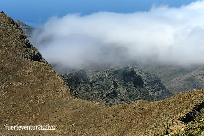
The Pico de la Zarza is the highest elevation in Fuerteventura. It rises up to 807 meters above sea level. It is rooted in the Macizo de Jandía, a ridge that divides the Jandía peninsula into the leeward and windward slopes, both different and with their geological singularities.
From the top of Pico de la Zarza, on clear days, you have a wide view of the island. To the left and at your feet, you will see how the Cofete arch seems to stretch towards the island of Gran Canaria. The Winter house, the Roque del Moro, the Islote and the village of Cofete, are points of easy location and that seem to have an amazing feeling of closeness, as if they were at your fingertips. While on the right flank you have more than 170 kilometers of paradise to discover.

Despite the fact that mountains, valleys and ravines overlap trying to confuse the observer, from this natural watchtower, it is not difficult to distinguish the Jables de Pecenescal, Playa de la Pared, Montaña Cardón, the Massif de Betancuria and part of the Central Knives system. from Fuerteventura.
If you want to enjoy these wide views, before putting on your trekking boots, you will have to check the weather forecasts. Because if there is something characteristic of Pico de la Zarza, it is that, for much of the year, there is a small sea of clouds that covers everything. This is due to the succession of hills in the Jandía massif. Most of the peaks of this massif exceed 700 meters in altitude, retaining the clouds on the side of Cofete (windward), and protecting the intermediate lands from the constant winds.
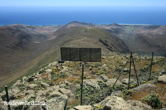
Thanks to the fact that the clouds remain swarming on the western slope of Pico de la Zarza, it is possible to collect part of the water that is concentrated in them. The Cabildo of Fuerteventura installed, in 2016, several mist collectors that collect 6,500 liters of water per month.
The biodiversity of Pico de la Zarza.
The privileged location of Pico de la Zarza not only guarantees you one of the best views of Fuerteventura, but also, here you can discover a wide animal and plant biodiversity. Almost 90% of the endemic flora of Fuerteventura can be found at the Pico de la Zarza, as in its surroundings. Among the most noteworthy plants are the Jandía tajinaste, the Winter margarita, the jorao and the cuernúa.
But the biological jewel of Pico de la Zarza is in shady areas, almost hidden. They are remnants of thermophilic forests, similar to laurisilva.

Jandía, and especially the Pico de la Zarza, is an Area of Special Interest for ornithological observation. During the route you will have the opportunity to spot more than twenty nesting birds: the bustard, the Ibis, the Barbary falcon, the guirre, the harrier and the Canary crow, are some of the most representative birds that inhabit the area. But also Canarian shrews, lilies, majorero perenches, hedgehogs and Moorish squirrels, have been running around these lands for a long time.
How to ascend to Pico de la Zarza?
The best way to get to the top of Pico de la Zarza is to do it along the PR FV-54 route. The path connects Morro Jable with the mentioned peak, through a wide dirt track that runs along a hillside. On both sides of the slope are two impressive ravines: Vinamar and Butihondo.
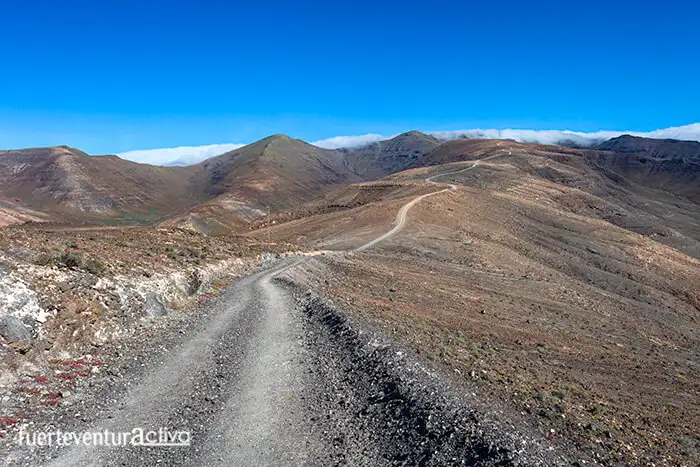
The path is just over 7 km long, ascending all the way. It takes between 2 and a half hours and 3 hours to reach the geodetic point at the top. The beginning of the path is next to a water tank, after passing the Barceló hotels in the town. But, to make it easier, here is the link to the starting point of the route. Also, this is a good place to leave the vehicle.
Different names for Pico de la Zarza
The origin of the toponym Pico de la Zarza is given, as many may guess, because it is one of the few enclaves in Fuerteventura where there were a large number of common brambles. Yes, Those that give us delicious blackberries in summer.
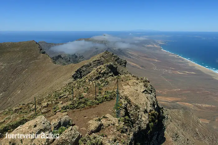
Among the inhabitants of Morrojable, the Pico de la Zarza, is also known as Pico de los Ingenieros (engineers peak). The reason for this peculiar name is because, after the Second World War, Gustav Winter tried to repopulate Pico de la Zarza with more than one hundred thousand Canarian pines. This repopulation was never carried out.
But if there is a curious name for this mountain, Orejas de Asno, (donkey ears). The name is due to the fact that the Pico de la Zarza next to the peak of the Fraile, resemble, from a distance, the ears of this animal.
PR FV 54: Morro Jable – Pico de la Zarza
Length: 2 h 30 min
Distance: 7,5 km.
Level: Hard.
GPX route
Route in Google Earth
Route in PDF


