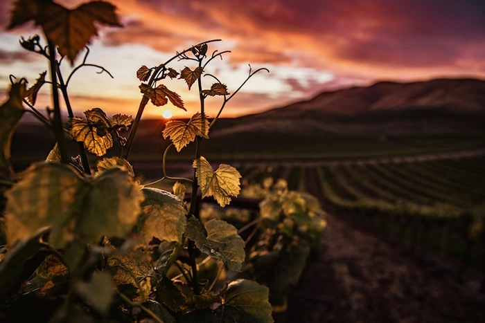
Since the volcano Cumbre Vieja eruptedin La Palma on September 19, 2021, interest in other volcanoes in the Canary Islands has increased.
The geological history of Fuerteventura is complex, and cannot be exhaustively exposed in this blog. However, we will provide you with some information about its origins. We will also delve into the latest eruptions on the island in more detail.
How was Fuerteventura formed?
Fuerteventura is the longest-lived island in the Canary archipelago. It is approximately 22 million years old. However, its roots are much older.
The island has been formed by the accumulation of volcanic materials emitted over millions of years. Cycles of great volcanic intensity have alternated with other periods of apparent calm.
The base on which the insular building stands is an oceanic-type crust, about 18 km thick. On it rise the islands of Fuerteventura and Lanzarote, which constitute a unique volcanic edifice.
Basaltic rocks, padded lava, sandstones and other materials overlapped on this root, giving rise to an underwater building. Its emergence gave rise to the island of Fuerteventura. This underwater volcano was formed in a period between 30 and 23 million years.
During the eruptive periods, pyroclastic flows, lava, and various materials that formed lava deltas emerged on the already emerged part of the Island. This is what geologists call the Basal Complex of Fuerteventura, and it corresponds practically with the Betancuria massif.
Some of the volcanic buildings of the Basal Complex could reach, in their origin, the 3500 meters of height.
Thousands of years later another volcanic island began to form, below the central building, it would be the current Jandía. And some time later another to the north. These three original islands ended up merging forming a single island: Fuerteventura
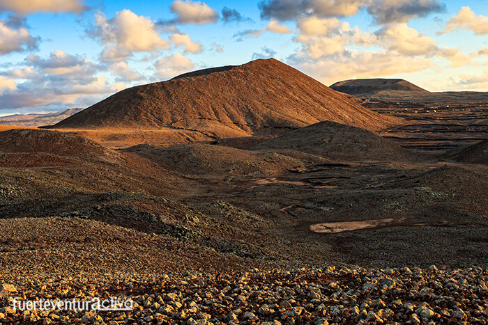
Around 185,000 years ago, the Montaña de la Arena volcano erupted, putting the island's boundary there. But just 50,000 years later there was a powerful fissure eruption that gave rise to the Bayuyo volcano alignment.
Bayuyo Alignment: The youngest volcanoes in Fuerteventura
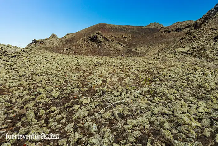
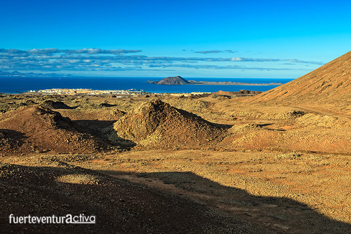
The Bayuyo alignment is a set of volcanic buildings that erupted at the same time, following an almost straight line in a northeast-southwest direction.
These volcanoes are characterized by being circular in plan, and their calderiform craters. They range from Isla de Lobos to Montaña Colorada, and are made up of seven impressive craters that, together with the surrounding badlands, carve out one of the most spectacular landscapes in the north of Fuerteventura.
Just over 135,000 years ago, Fuerteventura ended more or less at Montaña Roja. It was then that intense volcanic activity began in the extreme north of the island. Through a fissure, several magmatic material emitting centers emerged, expanding the surface of Fuerteventura by 112 square km to the north. That is, from Montaña La Arena to El Cotillo. At that time the Isla de Lobos was also formed.
Volcanoes of the Bayuyo alignment:
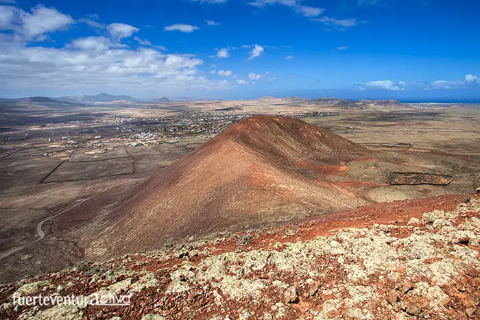
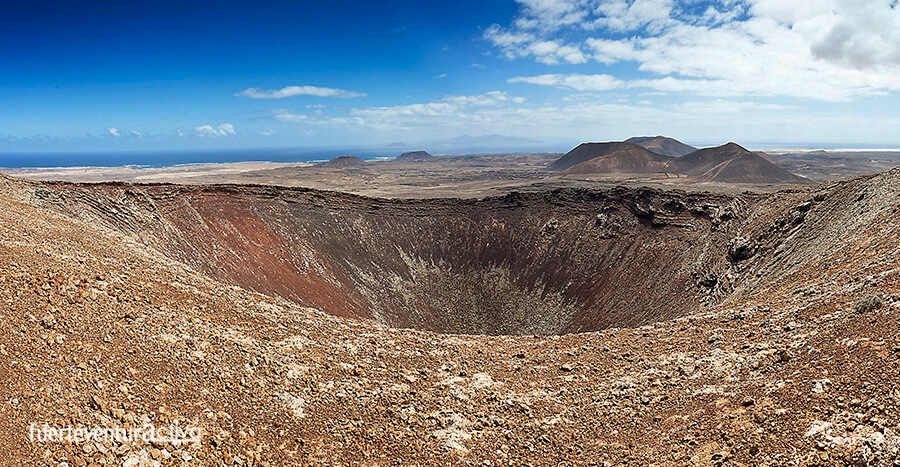
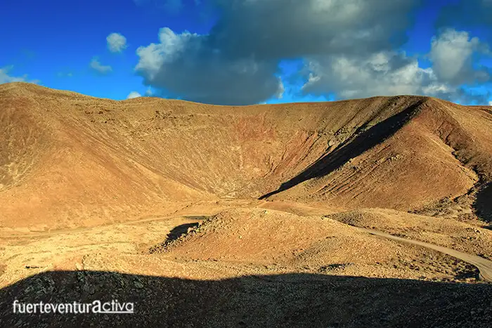
Calderón Hondo: Its crater is about 70 meters deep and 100 in diameter. Access to its crown is easy, as it has a well-marked path.
Calderón Hondo and Montaña Colorada are fused by a stack of lavas, which was the original emission center.Caldera Rebanada and Caldera Encantada, located northeast of the Calderón Hondo, are linked to a crater that forms a large funnel. Neither of the two exceeds 140 meters in height.
Las Calderas is the volcanic cone that is located to the northeast of the previous ones. It has an uneven crater open to the Northeast. At its feet, the formation of important little furnaces stands out.Bayuyo Mountain. Its unevenness, from the base of the cone to the top, is just over 160 meters. It has a signposted path from which you can see the interior of the crater. San Rafael, is the crater with the highest height from the base, 190 meters. Also the largest and most visible of the Bayuyo lineup.
What does Bayuyo mean?
Bayuyo is a word used by the Canarian aborigines. With it they designated an atmospheric phenomenon that occurs in the days close to the summer solstice. It is a kind of mist that forms at the foot of some mountains, near the sea. The mahos related this phenomenon to the spirits of their ancestors who came to give them advice.
Can you visit the Bayuyo lineup?
Yes, there is a wide dirt track that connects Lajares with Corralejo. It can be traveled by bike or by vehicle, suitable for rough terrain. The winding route follows the slopes of the volcanic cones of the geological complex. We leave you here the link to the beginning of the route through Bayuyo.
Is there a likelihood of volcanic eruptions in Fuerteventura?
Geologists and volcanologists consider that the volcanoes of Fuerteventura are extinct, and therefore there is no probability that a volcanic eruption will occur on our island. In fact, between 1914 and 1917 the south of Fuerteventura suffered various seismic swarms of volcanic origin, similar to those prior to the eruption of Cumbre Vieja, in La Palma. However, the magma found no chink to rise to the surface.
[ux_product_categories]
Fuerteventura2
 Fuerteventura is the longest-lived island in the Canary archipelago. It is approximately 22 million years old. However, its roots are much older.
The island has been formed by the accumulation of volcanic materials emitted over millions of years. Cycles of great volcanic intensity have alternated with other periods of apparent calm.
The base on which the insular building stands is an oceanic-type crust, about 18 km thick. On it rise the islands of Fuerteventura and Lanzarote, which constitute a unique volcanic edifice.
Basaltic rocks, padded lava, sandstones and other materials overlapped on this root, giving rise to an underwater building. Its emergence gave rise to the island of Fuerteventura. This underwater volcano was formed in a period between 30 and 23 million years.
Fuerteventura is the longest-lived island in the Canary archipelago. It is approximately 22 million years old. However, its roots are much older.
The island has been formed by the accumulation of volcanic materials emitted over millions of years. Cycles of great volcanic intensity have alternated with other periods of apparent calm.
The base on which the insular building stands is an oceanic-type crust, about 18 km thick. On it rise the islands of Fuerteventura and Lanzarote, which constitute a unique volcanic edifice.
Basaltic rocks, padded lava, sandstones and other materials overlapped on this root, giving rise to an underwater building. Its emergence gave rise to the island of Fuerteventura. This underwater volcano was formed in a period between 30 and 23 million years.
 During the eruptive periods, pyroclastic flows, lava, and various materials that formed lava deltas emerged on the already emerged part of the Island. This is what geologists call the Basal Complex of Fuerteventura, and it corresponds practically with the Betancuria massif.
Some of the volcanic buildings of the Basal Complex could reach, in their origin, the 3500 meters of height.
Thousands of years later another volcanic island began to form, below the central building, it would be the current Jandía. And some time later another to the north. These three original islands ended up merging forming a single island: Fuerteventura
During the eruptive periods, pyroclastic flows, lava, and various materials that formed lava deltas emerged on the already emerged part of the Island. This is what geologists call the Basal Complex of Fuerteventura, and it corresponds practically with the Betancuria massif.
Some of the volcanic buildings of the Basal Complex could reach, in their origin, the 3500 meters of height.
Thousands of years later another volcanic island began to form, below the central building, it would be the current Jandía. And some time later another to the north. These three original islands ended up merging forming a single island: Fuerteventura
 Around 185,000 years ago, the Montaña de la Arena volcano erupted, putting the island's boundary there. But just 50,000 years later there was a powerful fissure eruption that gave rise to the Bayuyo volcano alignment.
 Just over 135,000 years ago, Fuerteventura ended more or less at Montaña Roja. It was then that intense volcanic activity began in the extreme north of the island. Through a fissure, several magmatic material emitting centers emerged, expanding the surface of Fuerteventura by 112 square km to the north. That is, from Montaña La Arena to El Cotillo. At that time the Isla de Lobos was also formed.
 Calderón Hondo: Its crater is about 70 meters deep and 100 in diameter. Access to its crown is easy, as it has a well-marked path.
Calderón Hondo and Montaña Colorada are fused by a stack of lavas, which was the original emission center.
Caldera Rebanada and Caldera Encantada, located northeast of the Calderón Hondo, are linked to a crater that forms a large funnel. Neither of the two exceeds 140 meters in height.
Las Calderas is the volcanic cone that is located to the northeast of the previous ones. It has an uneven crater open to the Northeast. At its feet, the formation of important little furnaces stands out.
Bayuyo Mountain. Its unevenness, from the base of the cone to the top, is just over 160 meters. It has a signposted path from which you can see the interior of the crater. San Rafael, is the crater with the highest height from the base, 190 meters. Also the largest and most visible of the Bayuyo lineup.
Calderón Hondo: Its crater is about 70 meters deep and 100 in diameter. Access to its crown is easy, as it has a well-marked path.
Calderón Hondo and Montaña Colorada are fused by a stack of lavas, which was the original emission center.
Caldera Rebanada and Caldera Encantada, located northeast of the Calderón Hondo, are linked to a crater that forms a large funnel. Neither of the two exceeds 140 meters in height.
Las Calderas is the volcanic cone that is located to the northeast of the previous ones. It has an uneven crater open to the Northeast. At its feet, the formation of important little furnaces stands out.
Bayuyo Mountain. Its unevenness, from the base of the cone to the top, is just over 160 meters. It has a signposted path from which you can see the interior of the crater. San Rafael, is the crater with the highest height from the base, 190 meters. Also the largest and most visible of the Bayuyo lineup.
 Bayuyo is a word used by the Canarian aborigines. With it they designated an atmospheric phenomenon that occurs in the days close to the summer solstice. It is a kind of mist that forms at the foot of some mountains, near the sea. The mahos related this phenomenon to the spirits of their ancestors who came to give them advice.
 Yes, there is a wide dirt track that connects Lajares with Corralejo. It can be traveled by bike or by vehicle, suitable for rough terrain. The winding route follows the slopes of the volcanic cones of the geological complex. We leave you here the link to the beginning of the route through Bayuyo.