Routes and trails
Ascent to Mountain of La Muda
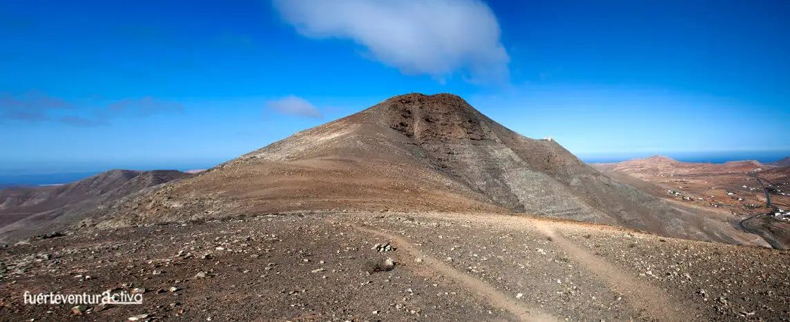
The climb to Mountain of La Muda, a short route of no more than 3km, is a good example of the rich landscape of the island.
Where is Montaña de la Muda located?
Montaña de la Muda rises in front of the town of La Matilla. It belongs to the municipality of Puerto del Rosario, being the northern limit of the capital municipality. Its summit, 689 meters above sea level, makes it not only the highest elevation in the north of Fuerteventura, but also the Vallebrón Protected Landscape, to which it belongs.
The Protected Landscape of Vallebrón, represents a geomorphological unit of knife relief, of great beauty, and of high landscape and ethnographic value.
Its strategic location, nestled in front of the magical mountain of Tindaya, together with the abundance of water and its altitude, made this elevation have a great relevance from the first moments of the occupation of Fuerteventura. So much so, that the highest area of the mountain was known, since the 15th century, as “Church of the Majos”, “church of the Canaries”, “Oratorio de los majos”
Muda Mountain Trail
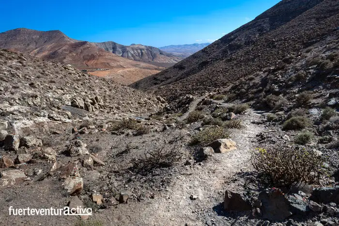
The path enabled by the south face of Montaña de la Muda is quite steep. In less than 3 kilometers of travel you will go from 340 meters of altitude to 575. The path will take you from the base of the mountain to a plain: the Espigón de la Mesa, a place high enough to be able to admire all the beauty around you.
Higher up the plain it is not advisable to climb, as there are no trails enabled and the wind blows very strongly in these parts, causing accidents. Furthermore, this area is especially sensitive to the transit of people. Without knowing it, we could be altering and modifying the footprints of our ancestors.
The start of the trail is at km 13rd of the Fv-10 road, just 500 meters from the village of La Matilla.
At the edge of the road there is a siding, flanked by small wooden posts. It has the capacity to park 2 or 3 vehicles, no more.
Once the vehicle is parked, direct your steps towards a wide dirt track, with steps.
A few minutes after starting the route we will see several structures of ethnographic interest. The first and most prominent is a shepherd’s shelter.
The so-called “souks” are stone shelters used by the ancient shepherds of Fuerteventura to spend the night, and shelter from inclement weather. These refuges were found in points of good visibility, on the routes most frequented by the herds. Although it was usual to use small natural caves, and even volcanic cracks, the most common to build these “Souks”
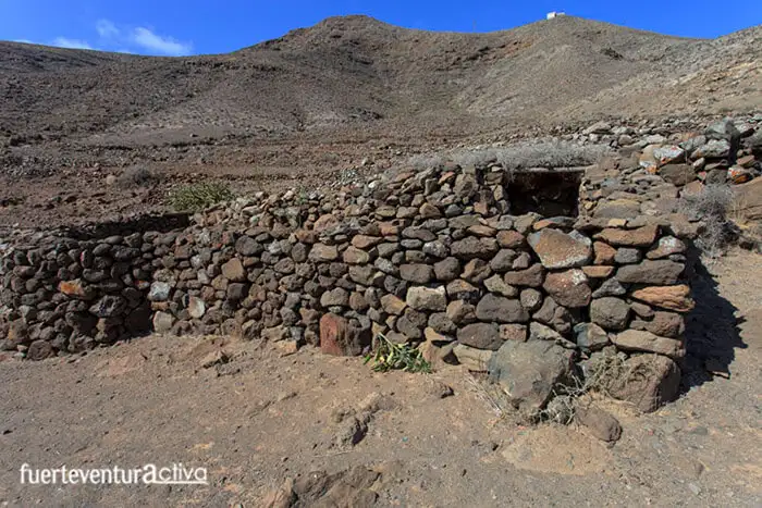
Next to them we find several “cat flaps”. They are circular shaped structures, no more than a meter and a half in diameter, made of stones and roofed with bushes (mainly gorse and thorns).
The main mission of the cat flats was the protection of the baifos (baby goats). The shepherds put the calved goats with their babies in these cat flats, for a little over a week. With this action they prevented the crows, or wild dogs, from killing the baifos. When there was not enough space for the goat to stay with the young, the enclosures were called “goires” or “bullpen”, and they were exclusively for the newborn baifos.
From that point on the path narrows, it becomes quite sinuous, crossing the Barranco del Risco on several occasions. The slope begins to show. If you are not used to long ascents, make several stops to observe your progress towards the top.
In the intermediate area of the path and just at the points where the path passes from one side of the ravine to the other, you will find three wells reinforced with stones. These wells are known as Fuentes del Chupadero.
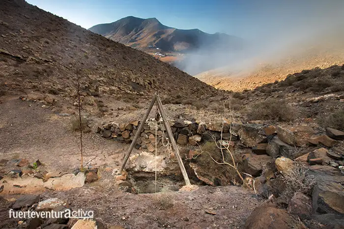
In Montaña de la Muda there are a dozen wells, which have been used for centuries to extract both the filtered water from the subsoil and the surface water carried by runoff.
At the top of the path, and a few meters from the end, you will see an ancient era where cereals were threshed. The slopes of Mountain of the Muda were once cultivated with cereal.
Once we reach the small plain, the Tindaya Mountain opens up before our eyes, imposing. If we climb just a few more meters, we will see a good part of the eastern and western coast of Fuerteventura, even on clear days the panorama extends to the north, seeing the islet of Lobos and the neighboring island of Lanzarote.
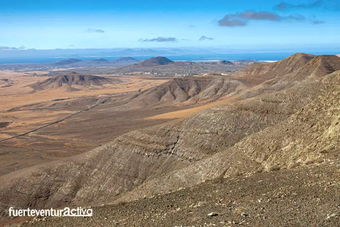
The view to the south is also spectacular. We can see in the foreground the Aceitunal, the Morro de la Fortaleza, a little further on the Betancuria massif and, in the distance, the summits of Cardón Mountain.
The diversity of the flora of Montaña de la Muda varies enormously between its northern and southern slopes.
On the south side, the slope that we have discussed in this article, we find plant species of more arid habitats such as asparagus, tabaibas, gorse, sea thorn and green.
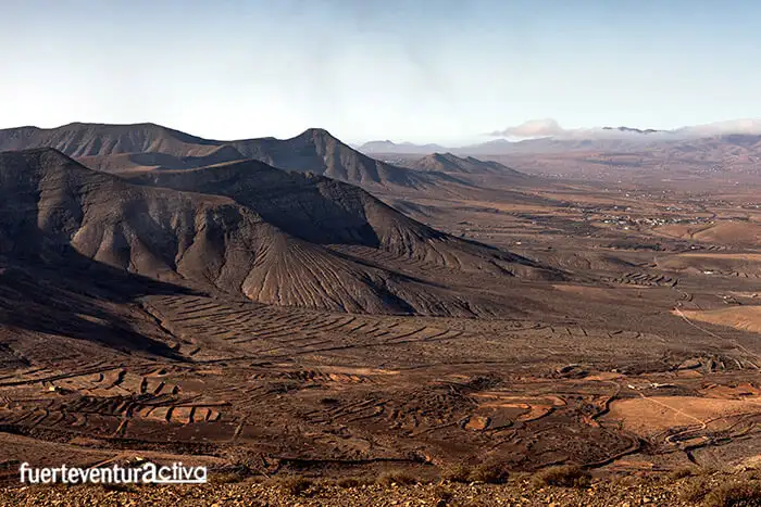
Altabacas, bushes, jerky, joraos, and turmeros, among other species, live on the north slope, but there are also wild olive trees.
As for the fauna, the birds stand out, such as the Canarian calandria, the road pipit, the stone curlew, the ortega ganga, corridor, partridge, bustard, hoopoe and blue tit. Hovering around the area you will not miss seeing kestrels, hawks, guirres, and the omnipresent crows.
Ah! by the way, Montaña de la Muda has another trail on its north flank: The PR – FV 9 trail. If you are interested in learning more about these trails, be attentive to the blog posts, or better yet, sign up for our newsletter.
Fuerteventura2

